
News Summary
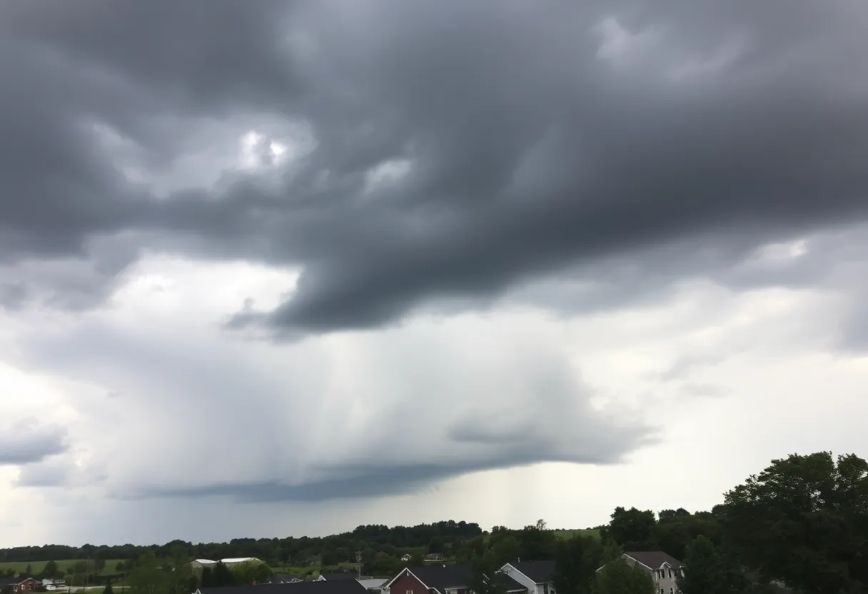
With severe weather on the horizon, the Warren County Emergency Management Agency has canceled the Community Outdoor Warning Siren test originally slated for Friday, April 4. The forecast predicts 6-10 inches of rainfall, raising concerns over flash flooding. In neighboring regions, swift water rescues have already been reported. Residents are urged to stay informed and prepare for the inclement weather that is set to begin Wednesday, April 2. The predictions include strong storms, possible tornadoes, and damaging winds, making safety preparations essential.
Warren County Braces for Severe Weather: Outdoor Siren Test Canceled
Folks in Warren County, it looks like Mother Nature is gearing up for a pretty wild week ahead! In light of the severe weather forecast, the Warren County Emergency Management Agency (EMA) has made the decision to cancel the Community Outdoor Warning Siren test that was scheduled for Friday, April 4. This precautionary move aims to lessen any anxiety amongst locals who might already be feeling the stress that comes with storm-related chatter.
What to Expect: Heavy Rain and Flooding
The stormy weather is expected to kick off sooner than you might think, starting Wednesday, April 2. With forecasts predicting an astounding six to ten inches of rainfall over the next week, flash flooding is anticipated to be a major concern in the area. This isn’t just a minor sprinkle—this is shaping up to be a significant weather event!
It’s not just Warren County feeling the pressure; neighboring regions have already reported swift water rescues due to intense flash flooding. Reports from areas of Virginia and West Virginia reveal that heavy rains have led to dangerous conditions, with rivers and creeks swelling over their banks. It’s a reminder that even if it seems calm now, drastic changes can happen quickly in weather patterns.
Keep Your Eyes on the Forecast
The National Oceanic and Atmospheric Administration (NOAA) has issued warnings about the likelihood of excessive rainfall hitting places from western Tennessee right into Kentucky. Some locations have reported over five inches of rain just during the weekend! If you’re hoping the weather will clear up soon, it may not be the case since forecasts indicate that cooler and quieter conditions won’t roll in until Monday.
On that day, while there may still be a few lingering rain showers early in the morning, highs are only expected to reach around 60 degrees. So grab your umbrellas and jackets, folks! It’s definitely not the warm spring weather we were hoping for.
What’s Coming Up This Week
Starting Wednesday, however, that calm will get thrown out the window. The Storm Prediction Center has identified Wednesday as a First Alert Weather Day due to the potential for severe weather, which could get even worse as we move into Thursday. Strong storms are expected to hit the area, with an enhanced risk alert already issued for Sunday night, predicting damaging winds, possible tornadoes, and large hail.
It’s crucial to stay updated! The weather forecasts can change rapidly, and local updates are best found through reliable resources. It’s not just about watching the skies; it’s about staying informed so you know what to expect!
Stay Safe and Prepared
As we gear up for this weather adventure, it’s a good time for everyone in Warren County and surrounding regions to prepare. Make sure you have your emergency kits handy, check on neighbors and friends, and keep your phones charged. No one likes to deal with a power outage during a storm!
Let’s all look out for each other in our communities and hope that everyone stays safe during this stormy weather. Remember, it’s always better to be prepared and informed. Here’s to calmer winds and safer days soon!
Deeper Dive: News & Info About This Topic
HERE Resources
WKU Braces for Severe Storms: Safety Guidelines for Students and Staff
Samantha Brown Selected for Gatton Academy
Margaret Simmons Invitational Set for March in Bowling Green
Bowling Green Man Steals Eight Corvettes: A Shocking Heist
Bowling Green Schools Unveil Major Facility Overhaul
Bowling Green Schools Approve $60 Million Facilities Plan
Bowling Green Confronts Heartbreaking Accidents on I-165
New Transportation Facility to Bring Jobs to Bowling Green
Residents of Bowling Green Urged to Manage Energy Bills as Cold Weather Hits
Bowling Green Community Mourns After Fatal I-65 Collision
Additional Resources
- WBKO: Alert Severe Weather Expected Tonight
- Wikipedia: Severe Weather
- WBKO: Severe Risk Sunday
- Google Search: Severe Weather Predictions
- Weather.com: Severe Storms and Flooding
- Google Scholar: Severe Weather Impact
- BG Daily News: Opn Imel
- Encyclopedia Britannica: Natural Disasters
- Spectrum News: Bowling Green Prepares for Snowstorm and Flooding
- Google News: Flooding News